
Thornbury rural
Thornbury rural covers the rural area around Thornbury, extending to the river Severn in the west and the M5 in the east – plus Itchington which is also included. To the north you can travel as far as Falfield, while in the south, shared zones allow you to travel to Severn Beach, Easter Compton and Cribbs Causeway. You can also travel to UWE and Southmead Hospital.
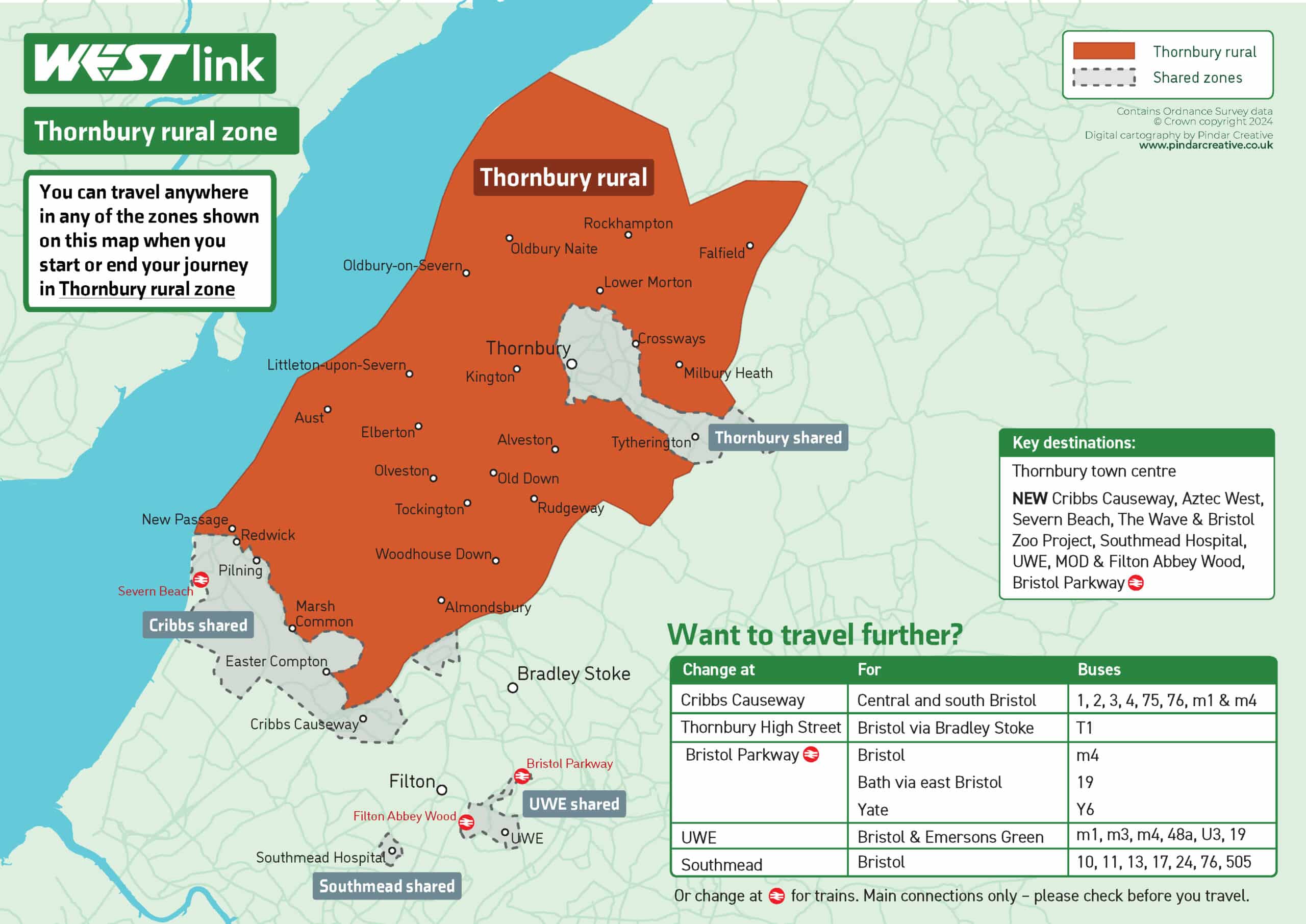
What zones can you also travel to?
- Thornbury shared
- Cribbs shared
- UWE shared
- Southmead shared
If you want to travel further afield
You can travel longer distances with a Westlink – simply connect with standard buses or trains. Here’s just a few of the most convenient places to change.
| Change at | For | Buses |
|---|---|---|
| Cribbs Causeway | Central and south Bristol | 1, 2, 3, 4, 75, 76, m1 & m4 |
| Thornbury High Street | Bristol via Bradley Stoke | T1 |
| Bristol Parkway* | Bristol Bath via east Bristol Yate | m4 19 Y6 |
| UWE | Bristol & Emersons Green | m1, m3, m4, 48a, U3, 19 |
| Southmead | Bristol | 10, 11, 13, 17, 24, 76, 505 |
You can also travel directly to a number of places on a Westlink from Thornbury rural zone including Thornbury town centre, Cribbs Causeway, Aztec West, Severn Beach, The Wave & Bristol Zoo Project, Southmead Hospital, UWE, MOD & Filton Abbey Wood and Bristol Parkway.