


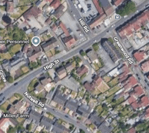
Worle High Street improvement works to begin later in the year following programme revisions
Work to improve Worle High Street in Weston-super-Mare is set to get underway later in the year following changes to...
Read more
The Pill Precinct Transport Hub was launched on Saturday, with local people coming together to celebrate the transformation of the area alongside the return of the village’s popular market.
The scheme has created a more welcoming and accessible public space, making it easier and more comfortable to travel, shop and spend time in Pill. Improvements include upgraded bus facilities, safer pedestrian crossings and enhancements to the wider precinct environment.
The project has been shaped by feedback from the local community, with contributions from residents, businesses, Parish and Ward Councillors helping to inform the final design. Additional paving improvements have also been supported by Alliance Homes.
Alliance Homes Head of Assets and Sustainability, Matt Sands said: “It’s been a pleasure to work with North Somerset Council to deliver this new transport hub and precinct improvements. These enhancements will benefit our customers and the wider community, creating a more welcoming space and improving access to public transport.”
As part of the opening event, a special tribute was made to a much-missed member of the Pill community. Local resident Lou Dixie helped mark the occasion with the installation of a memorial bench.
Cllr Hugh Malyan, North Somerset Council’s Cabinet Member for Highways and Transport, said:
“It’s fantastic to see this new transport hub open in the heart of Pill. This scheme has been shaped by the community and designed to make it easier for people to travel, shop and spend time locally.
By improving bus facilities, safety and the public space, we’re helping to support local businesses and create a more welcoming environment for everyone. Thank you to everyone who helped bring this project to life.”
North Somerset Council would like to thank everyone who contributed to the scheme and joined the opening event, helping to bring renewed life to the precinct.
Work to improve Worle High Street in Weston-super-Mare is set to get underway later in the year following changes to...
Read more
In his first visit since becoming Prime Minister, this morning Andy Burnham joined the West of England's Mayor at the...
Read more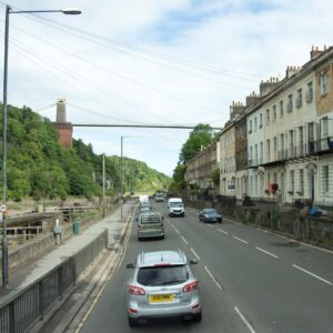
Essential resurfacing works will be taking place along the A4 Portway throughout this summer and autumn.
Read more
Work to make it safer and better for children and families to walk between three schools in Midsomer Norton is...
Read more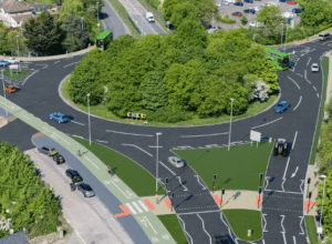
Plans to improve sustainable transport links along the A4 between Bath and Bristol are continuing to move forward as construction is...
Read more