


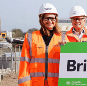
New name for station: Bristol Brabazon
The new railway station being built in North Filton has today been officially named: Bristol Brabazon.


Through radical changes to bus infrastructure, we are aiming to achieve shorter bus journey times and increase how reliable they are.
To do this, we are working to change some of the major roads across the city to make it easier for people to take the bus and to walk or cycle. It is part of plans to transform Bristol’s road network, introducing quicker and more reliable bus travel, cleaner air, and improved walking, wheeling and cycling routes.
The number 2 bus route, which travels along the A37 and A4018, is one of the main transport corridors in Bristol that we are working to improve.
Our aim is to provide a better travelling experience for those who take the bus, walk, wheel or cycle, to encourage more people to choose to make the switch over to sustainable transport, which will help reduce congestion and improve air quality.
Bristol City Council has updated its plans for part of the central section of the A37/A4018 project.
The plans cover:
The plans have been updated in response to a public consultation, held from November 2021 to January 2022, that covered the whole project.
The project aims to improve bus journey times, make walking, wheeling and cycling safer and easier, while making sure people can still access shops and cultural venues in the area.
We are sharing the updated designs with everyone, so they know what is planned for this popular and busy part of Bristol ahead of a statutory consultation on the updated plans in spring/summer 2025.
The A37/A4018 route is a 15-mile transport corridor from Stockwood to Henbury that follows the number 2 bus route.
We have divided the route into three geographical areas and are delivering the project over five work packages. This is because parts of the route are being constructed at different times as final designs are approved and contractors booked in to do the work.

We have split the project into three geographical areas and are delivering it over five work packages. This is because parts of the route are being constructed at different times as final designs are approved and contractors booked in to do the work.
Our plans for Queens Road, the Triangle, Park Street and College Green are part of work package three, which falls within the central section of the route.
The central section goes from the bottom of Whiteladies Road, down Park Street, through Cabot Circus, over Bristol Bridge, along Victoria Street, past Temple Meads and onto Bath Bridges.
Parts of the central route have already been built, including improvements to Bristol Bridge. Construction work at Victoria Street is also underway.
We are also aiming to bring some of the work at College Green forward, including refurbishing the traffic signals as they are beyond their operational lifespan.

The north section goes from the South Gloucestershire boundary on Station Road, along Knole Lane through to Southmead Road, onto Henleaze Road, over the Downs and onto Whiteladies Road.
We are proposing to engage with stakeholders on proposals in this section in early 2025. These proposals will form part of work packages four and five.
The south section starts from the Three Lamps junction on the A37 and follows Wells Road through Knowle, past Airport Road, onto West Town Lane and into Sturminster Road.
We are finalising these plans, which form work package two. Depending on the results of a statutory consultation and approval of the business case, we are aiming to start construction on site in summer 2025.
There may be further proposals developed as part of work package four within the south section.
In 2020 we asked for suggested improvements to the whole A37 and A4018 route.
Based on this feedback we created detailed designs, which we consulted on from November 2021 to January 2022.
Following the public consultation, we have updated the plans for the central section, which we are sharing for information ahead of holding a statutory consultation on the plans in spring/summer 2025.
Without more investment in our public transport network, by 2036 delays are forecast to increase by 40 per cent, journey times by 9 per cent, and CO2 emissions from transport by 22 per cent.
We need to make significant changes to our road network if we are to meet Bristol’s carbon neutral targets and respond to the travel needs of a growing population.
Investing in the city’s transport network – to speed up bus journeys and create a better environment for walking, wheeling and cycling – will give people more options when deciding how they travel.
The main plans for Queens Road, the Triangle, Park Street and College Green include:
This project sets out to:
Plans include:
Main changes to the plans following the public consultation include:


Plans include:
Main changes to the plans following the public consultation include:


Plans include:
Main changes to the plans following the public consultation include:


Plans include:
Main changes to the plans following the public consultation include:
Because of the old age of the traffic signals at the College Green and Canons Road junction, we are aiming to bring forward the construction work to refurbish the signals and the pedestrian and cycle crossings.
The remaining work, including installing the bus lane from St Augustine’s Parade, the no-left turn from Canons Road into College Green, and the new pedestrian access to College Green from Park Street, are still subject to the spring/summer 2025 statutory consultation and business case process and remain part of our central proposals.

Local traffic will still be able to access Park Street and side roads, but the route you drive will change.

The budget for the A37/A4018 transport corridor project is approximately £37.5 million. The central section is expected to cost around £15 million.
The project is being funded by the UK Government as part of the City Region Sustainable Transport Settlement, which is administered by the West of England Mayoral Combined Authority.
This funding aims to decarbonise transport and encourage people to use public transport and to walk and cycle more. It cannot be used for ongoing maintenance of roads or on other council services, such as housing.
We will hold a statutory consultation on all the traffic regulation orders, including the Park Street bus gate, in spring/summer 2025.
Following a decision on the statutory consultation and the business case, construction work could potentially begin in late 2025.
In the meantime, we will be speaking with local businesses to seek their input on what else they would like to see in the area.
Our objectives for the A37/A4018 transport corridor project are to:
We ran early engagement in 2020 on initial ideas for the area, followed by a public consultation from 29 November 2021 to 28 January 2022 to get comments on more detailed designs.
Designs were updated following public consultation. Since then, we have delivered the Bristol Bridge section of the project and we have now begun construction of the Victoria Street section.
There are national and local strategies that this project aligns with, including:
We will be holding a statutory consultation in spring/summer 2025.
The business case will be considered by Bristol City Council and the West of England Mayoral Combined Authority in spring/summer 2025.
If the above processes are met and agreed upon by decision makers, construction could begin late 2025/early 2026.
The budget for the A37/A4018 transport corridor project is approximately £37.5 million. The central section is expected to cost around £15 million.
The project is being funded by the UK Government as part of the City Region Sustainable Transport Settlement, which is administered by the West of England Mayoral Combined Authority.
This funding aims to decarbonise transport and encourage people to use public transport and to walk and cycle more. It cannot be used for ongoing maintenance of roads or on other council services, such as housing.
A bus gate is a short section of road that only buses and authorised vehicles can use. They have the words ‘bus gate’ marked on the road at the entrance to the bus gate. Some also have a section of red road surface. Bristol’s bus gates are in use 24-hours a day, seven days a week. CCTV cameras operate to make sure drivers obey bus gate restrictions. Only buses and authorised vehicles can use bus gates.
A bus lane is marked by a solid, thick white line and the words ‘bus lane’ marked periodically on the road that normally runs in parallel to a lane for general traffic. Only buses and authorised vehicles can use a bus lane.
A continuous pavement is a footway that runs alongside the edge of a road and continues unbroken and at the same level across the junction of a side road, with markings used to indicate priority to pedestrians and/or cyclists. While they them down, vehicles can still cross over a continuous pavement, but priority is given to pedestrians and cyclists.
A two-way segregated cycleway is separated physically and completely from the highway and pavement. It runs in two directions.
A single lane segregated cycleway is separated completely from the highway and pavement and runs in parallel with the existing highway in one direction.
Yes. Vehicular traffic would still be able to access Park Street and College Green.
All traffic not authorised to pass through the bus gate or bus lane would be able to access Park Street by St George’s Road, which could be approached via Park Row and/or Jacob Wells Roundabout.
Blue badge holders driving to the Park Street area will need to use St George’s Road to enter the scheme area as they will not be authorised to use the proposed bus gate at the top of Park Street or the bus lane at the bottom of College Green.
General traffic will need to use alternative routes. These routes may involve using Park Row, Jacob Wells Road or routes through the centre. Please see the through traffic maps below.

Above are four maps showing the direction traffic can take to avoid travelling down Park Street and through College Green, including junctions that handle through traffic, through traffic from Whiteladies Road, Traffic from St James Barton Roundabout, and through traffic from Jacob’s Wells Road.
Pay & display parking and disabled parking would be available on the west side of Park Street. Almost all pay & display parking would be removed from the Triangle. People needing to park nearby could access West End long-stay car park.
Proposals include adding 16 new disabled parking bays on Park Street and the Triangle.
There would be dedicated loading bays provided at regular intervals on Park Street and the Triangle.
Richmond Hill and Park Place would no longer be used by through traffic but would remain accessible from the west via Queens Road. Traffic would be two-way on Richmond Hill, helped by a turning circle at the eastern end of Richmond Hill.
Charlotte Street and Great George Street would remain accessible, although traffic would use St George’s Road to access Park Street.
Great George Street would be one-way from the junction of Park Street to the junction of Hill Street and Charlotte Street would be one-way from the junction of Hill Street to Park Street. The rest of Great George Street and Charlotte Street would remain two-way.
Pedestrian access would be improved, benefitting from wider pavements and better crossings within the scheme area. Improvements to public space throughout the area would also enhance the pedestrian experience.
New signalised pedestrian crossings, crossing points at the same level as pavements, informal crossings, and crossing build outs would be installed as part of this project.
A new segregated cycleway connecting Whiteladies Road with Park Row would improve cycle access to the project area. Reducing vehicular traffic on Park Street would improve the cycling experience there.
Proposals include increasing the number of dedicated parking areas for bicycles and scooters.
We are proposing a series of improvements to a number of public spaces across the central section of the route, including:
Proposals include moving the Boer War Memorial to the new area of public space on Queens Road.
The plans do not include any changes to the fountain or Edward VII statue in front of the Victoria Rooms on Queens Road.
No, we do not plan to remove any trees. The plans include planting around 15 trees, subject to the underground utility arrangements.
Vegetation/planting along the central reservation on Queens Road would need to be removed, but the new public space would see a large area of green space and planting added, including new trees.

The new railway station being built in North Filton has today been officially named: Bristol Brabazon.
Households in Bristol without off‑street parking can now express their interest in taking part in a citywide trial run by...
Analysis of road safety along 100 roads with a 30 miles per hour (mph) speed limit is set to be...
Construction starts next week on a new walking, wheeling and cycling scheme in the historic city centre of Bath.

Figures from First Bus show which areas across the West of England saw the largest increases in children and young...