


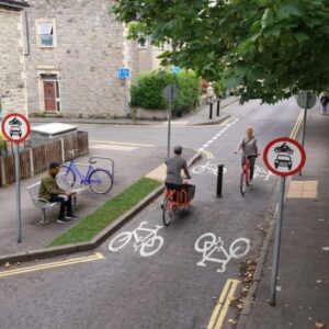
Long-term future of East Bristol Liveable Neighbourhood to be considered
The case for making the East Bristol Liveable Neighbourhood (EBLN) trial scheme permanent will be considered by Bristol City Council’s...
Read more
Working with Bath & North East Somerset, Bristol, North Somerset and South Gloucestershire councils, we’re aiming to provide high quality infrastructure to ensure the West of England is a region where cycling and walking are the preferred choice for shorter trips.
A consultation on the Local Cycling and Walking Infrastructure Plan ran from the 3rd of February 2020 until the 15th of March 2020.
Thank you to everyone who submitted their views during the consultation. Your responses to the questionnaire will be considered in the development of future plans for active travel in the region.
Local Cycling and Walking Infrastructure Plan Download pdf PDF approximately 18.48 M Consultation Report Download pdf PDF approximately 577.87 KCycling and walking route map numbers can be found on page 2 of the full Local Cycling and Walking Infrastructure Plan document.
The case for making the East Bristol Liveable Neighbourhood (EBLN) trial scheme permanent will be considered by Bristol City Council’s...
Read more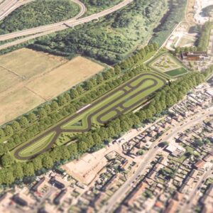
Plans for a landmark new Bristol Regional Cycling Hub, that could transform opportunities for cycling across the region, are set to be considered...
Read more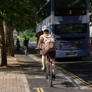
A major project designed to reduce the risk of flooding along the lower section of Whiteladies Road, while also improving...
Read more
Hundreds more young people in care, and care leavers, are set to benefit from up to ten years of free bus travel across the West of...
Read more
Safer, more direct cycling routes through Bath city centre will move forward later this year as over £2million has been...
Read more